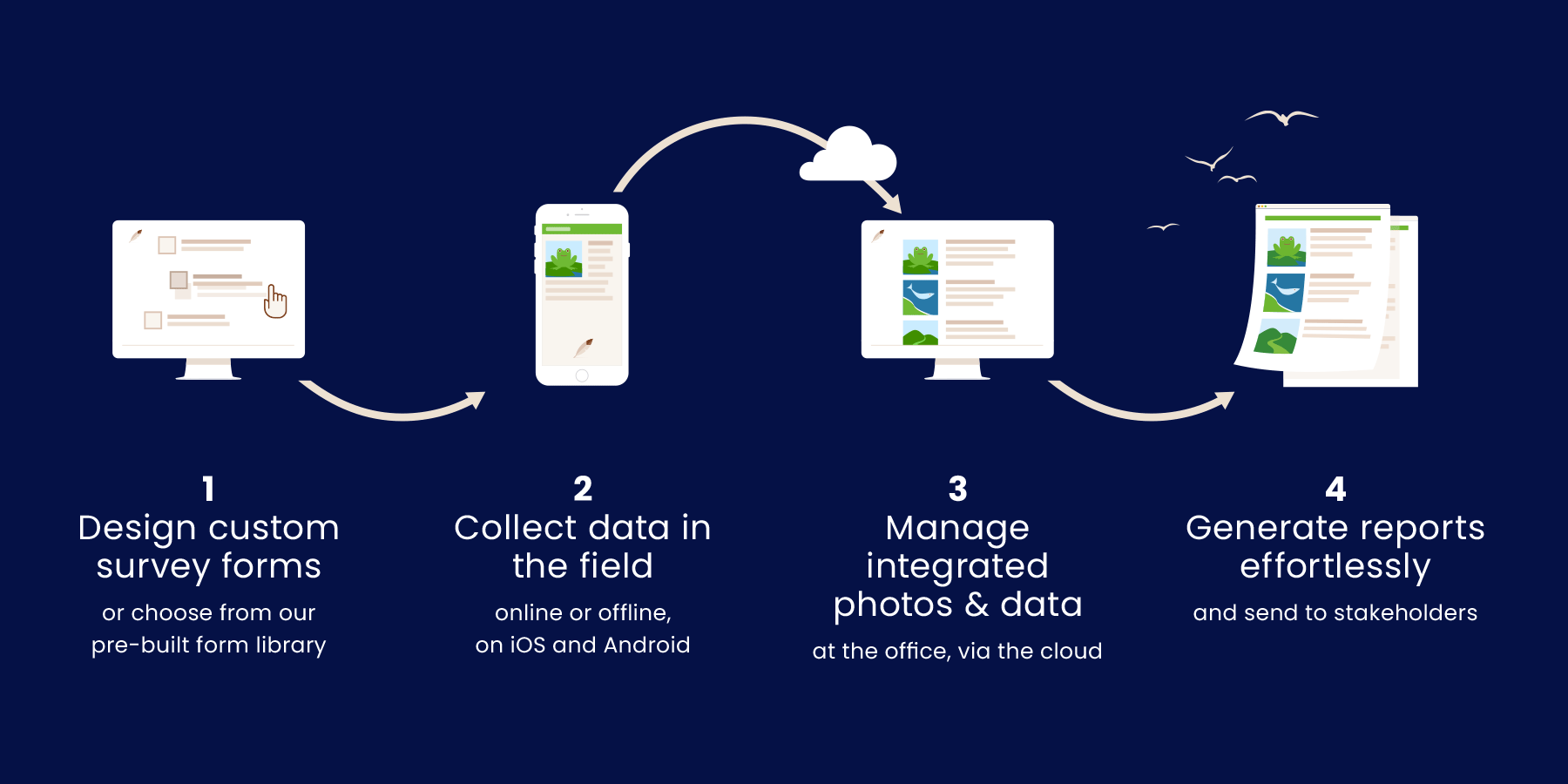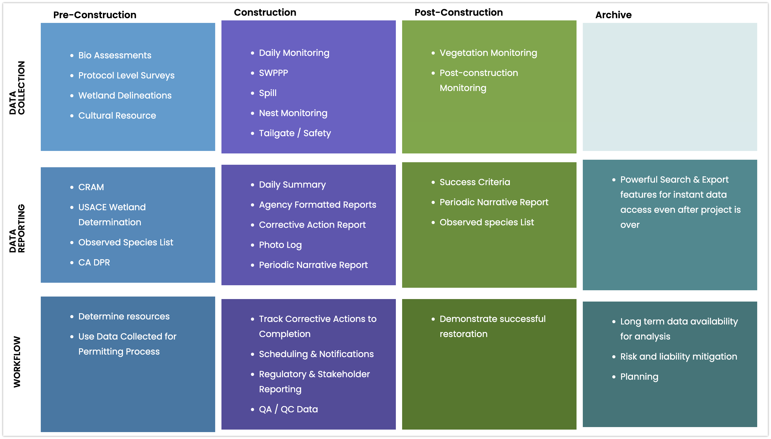

Every Wildnote feature is designed to make environmental consultants more efficient and help them save time by leveraging a single source of data to create multiple work products for a variety of stakeholders.
The complete solution for data collection and reporting, built specifically for environmental compliance management.
iOS & Android
Operates on the world’s most popular mobile devices.
Offline Capable
Sync on your terms when you return to WiFi or strong cell service.
Drag & Drop Survey Form Builder
Start from scratch or select from a collection of environmental compliance survey forms in our library.
Smart Search Picklists
Create your own picklists. Easily search long picklists using just a few key letters.
Photo Capture
Take photos within the mobile app or select from your camera roll.
Repeatable Fields
If you have recurring questions, the repeater feature allows you to collect a volume of data in a single digital form.
Digital Signature
Capture a signature whenever required.
Drop Geospatial Points
Record a latitude/longitude coordinate with a single tap; refine point location by moving base map.
Prebuilt Taxonomy Lists
Integrate flora and fauna taxonomy lists into your survey forms. Smart searchable by Latin or common name, or symbol.
Automatic SmartSync
Mobile data syncs automatically when connected to cellular data or WiFi.
Photo Gallery
View all photos associated with a project. Photos link to related data.
Search
Query projects using a variety of search criteria. Directly export results to PDF or Excel Pivot.
Role-based Access Control
Assign access and permissions to specific team members project-by-project.
Survey Duplicate
Make a copy of a completed survey and edit only where needed.
Robust Photo Management
Manage photos more efficiently with photo renaming, Dropbox integration, and agency photo sheet exports.
Survey Status
Assign a workflow status to a survey and track data through its lifecycle. Flag surveys by status.
Project Documents
Upload reference documents field data collection crews may require offline.
Export Data Formats
PDF, Word, Excel, KML, GDB, geoJSON
Survey Report
Compile all data collected, including photos and signatures, in a professionally designed PDF.
Photo Sheet Report
Create report-ready photo sheets with either 2 or 4 photos per page.
Customized Reports
Control branding, header details, selected photos, and questions to be included in reports.
Agency Ready Reports
USACE Wetland Determination, CA DPR and other agency-ready exports.
Narrative Report Builder
Query and summarize project data using a date range to inform narrative sections for agency reporting.
Taxonomy Lists
Select from USDA and USACE plant lists, invasive species, and wildlife lists (Latin and common names, and symbols).
Taxonomy Meta Data
Incorporate taxonomy meta data into exports, such as wetland indicator status by region, special species status listings, native/non-native status.
Customized Taxonomy Lists
Use our taxonomy framework to create your own sub-lists.
Taxonomy Favorites
Identify anticipated project taxonomy to create taxon name priority list for quick selection during field data collection.
Species Export
Creates a report-ready table that contains all species in a project with associate metadata, including listing status, native/non-native, indicator status, and more.
ESRI ArcGIS Pro & ArcMap
Export survey data to GDB or geoJSON for import into ESRI and non-ESRI mapping tools.
Dropbox
Easily download project photos to your Dropbox account.
Develop API
Integrate Wildnote data with your own data via our Developer API.
GNSS Devices
Integrates seamlessly with Trimble R1, EOS Arrow, Juniper Geode, and Bad Elf for sub-meter GPS accuracy.
Project Locations
Pre-define, search, and report on distinct locations such as sampling points, bird nests, and construction sites.
Project-based Setup
Organize your workflow by project, including survey forms, team members, field data, photos and documents.
Project Documents
Upload reference documents that field data collection crews may require offline.
Historical Data by Project Location
Query your database for previously recorded data pertaining to a location.
Scheduling
Email notifications to team members with project forms and details ensure projects run smoothly.
Programs
Group projects together under a program for high level management of data.
Still have questions?
Let us know. We are here to help.

Wildnote, Inc. 793 E Foothill Blvd. STE A #11 San Luis Obispo California 93405
+1 (805) 664 0090
Wildnote is a configurable software-as-a-service (SaaS) environmental consulting automation platform that helps you become more competitive, efficient, and profitable. We offer annual subscriptions with pricing based on the number of full-year and seasonal licenses, customizations, and support required.